St Mary's Church, Stifford
Introduction
The photograph on this page of St Mary's Church, Stifford by Stefan Czapski as part of the Geograph project.
The Geograph project started in 2005 with the aim of publishing, organising and preserving representative images for every square kilometre of Great Britain, Ireland and the Isle of Man.

There are currently over 7.5m images from over 14,400 individuals and you can help contribute to the project by visiting https://www.geograph.org.uk
St Mary's Church, Stifford
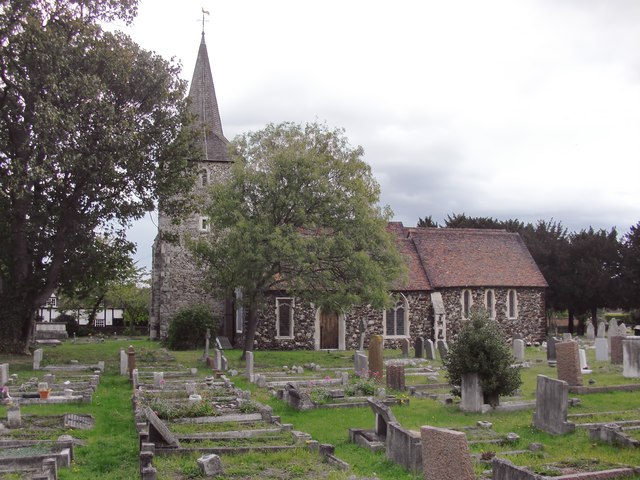
Image: © Stefan Czapski Taken: 17 Sep 2011
Very much in contrast to the industrial corridor along the Thames a few grid-squares to the south. In the Essex volume of 'The Buildings of England' Pevsner gives a 13th century date for the oldest parts of the church, including the tower. Shingles - wooden tiles - have been used for the cladding of the spire.
Images are licensed for reuse under creativecommons.org/licenses/by-sa/2.0
Image Location
Latitude
51.498962
Longitude
0.310019