Slip road and roundabout for Paddington Central
Introduction
The photograph on this page of Slip road and roundabout for Paddington Central by David Hawgood as part of the Geograph project.
The Geograph project started in 2005 with the aim of publishing, organising and preserving representative images for every square kilometre of Great Britain, Ireland and the Isle of Man.

There are currently over 7.5m images from over 14,400 individuals and you can help contribute to the project by visiting https://www.geograph.org.uk
Slip road and roundabout for Paddington Central
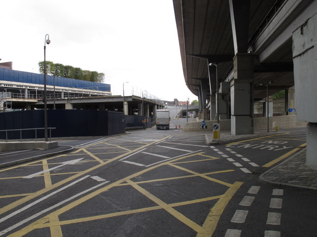
Image: © David Hawgood Taken: 17 Sep 2011
The roads here are in three layers. Top is the Westway, A40 elevated carriageway. Middle is the Harrow Road A404 Westbound. Bottom are service roads of Paddington Central and Paddington Basin. This photo taken from under Westway by the Battleship Building show the slip road up from a roundabout at bottom level to the middle level.
Images are licensed for reuse under creativecommons.org/licenses/by-sa/2.0
Image Location
Latitude
51.519682
Longitude
-0.182628