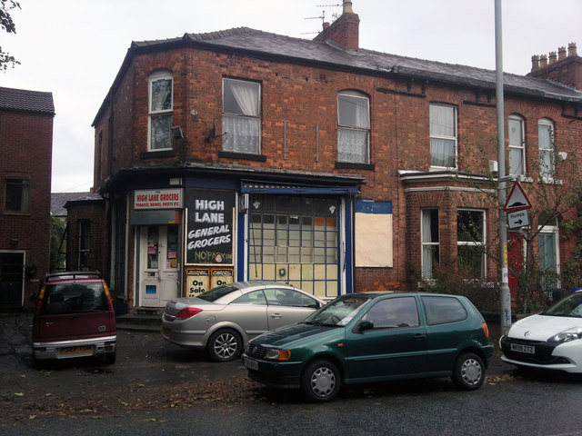
High Lane Grocers, Chorlton-cum-Hardy
Introduction
The photograph on this page of High Lane Grocers, Chorlton-cum-Hardy by Phil Champion as part of the Geograph project.
The Geograph project started in 2005 with the aim of publishing, organising and preserving representative images for every square kilometre of Great Britain, Ireland and the Isle of Man.
There are currently over 7.5m images from over 14,400 individuals and you can help contribute to the project by visiting https://www.geograph.org.uk

Image: © Phil Champion Taken: 23 Oct 2010
This was previously a bike shop (during the 1980s at least). The Michelin Man stickers in the window date from that incarnation. Prior to that it was a grocers shop. Manchester Libraries have a photo showing how it used to look. http://www.images.manchester.gov.uk/web/objects/common/webmedia.php?irn=38745 The police raided the property in 2009 following a tip off and recovered a large number of stolen items. http://menmedia.co.uk/manchestereveningnews/news/s/1311722_community_order_for_handling_stolen_goods_

