Nuthall Road: Newcastle Terrace
Introduction
The photograph on this page of Nuthall Road: Newcastle Terrace by John Sutton as part of the Geograph project.
The Geograph project started in 2005 with the aim of publishing, organising and preserving representative images for every square kilometre of Great Britain, Ireland and the Isle of Man.

There are currently over 7.5m images from over 14,400 individuals and you can help contribute to the project by visiting https://www.geograph.org.uk
Nuthall Road: Newcastle Terrace
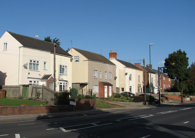
Image: © John Sutton Taken: 13 Sep 2011
These cottages date from the sinking of Thomas North's Newcastle Colliery (on land owned by The Duke of Newcastle) in 1853. The colliery, which was directly ahead, behind the terrace, closed in 1928, but a landsale wharf, where coal brought by rail from Cinderhill Colliery was supplied to coal merchants, survived until c. 1966 (it is still shown on 1967 OS maps). The houses of Staindale Drive and Wensleydale Close are built on the site of the wharf and associated railway sidings. For more about the Babbington Colliery Railway, see Image], Image], Image], Image] and others linked from them.
Images are licensed for reuse under creativecommons.org/licenses/by-sa/2.0
Image Location
Latitude
52.974103
Longitude
-1.187323