Bobbers Mill: Alfreton Road old and new
Introduction
The photograph on this page of Bobbers Mill: Alfreton Road old and new by John Sutton as part of the Geograph project.
The Geograph project started in 2005 with the aim of publishing, organising and preserving representative images for every square kilometre of Great Britain, Ireland and the Isle of Man.

There are currently over 7.5m images from over 14,400 individuals and you can help contribute to the project by visiting https://www.geograph.org.uk
Bobbers Mill: Alfreton Road old and new
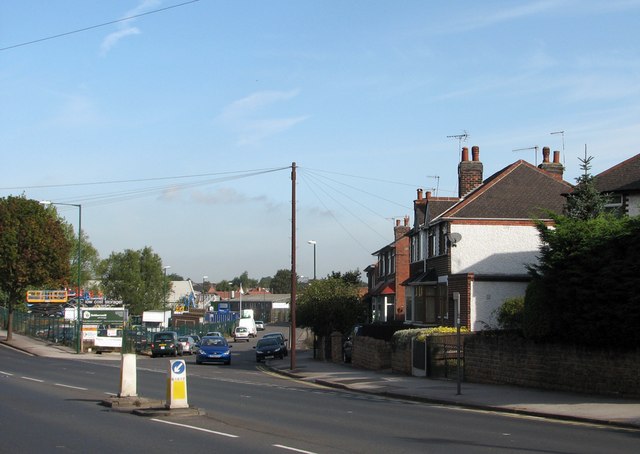
Image: © John Sutton Taken: 15 Sep 2011
The tarmac in the foreground is Alfreton Road, which becomes Bobbers Mill Bridge where the slope begins on the left of the picture. Bobbers Mill Bridge, built in the late 1930s at the same time as Western Boulevard as the city expanded westwards, replaced the old Alfreton Road, straight ahead, where there was once a level crossing over the Nottingham-Mansfield railway. The houses on the right are the same design as others in the area and also date from the late 1930s. The former Lindley & Lindley factory shown in Image] is behind them.
Images are licensed for reuse under creativecommons.org/licenses/by-sa/2.0
Image Location
Latitude
52.965432
Longitude
-1.181233