Short's Meadow, St Wulstans Nature Reserve
Introduction
The photograph on this page of Short's Meadow, St Wulstans Nature Reserve by Bob Embleton as part of the Geograph project.
The Geograph project started in 2005 with the aim of publishing, organising and preserving representative images for every square kilometre of Great Britain, Ireland and the Isle of Man.

There are currently over 7.5m images from over 14,400 individuals and you can help contribute to the project by visiting https://www.geograph.org.uk
Short's Meadow, St Wulstans Nature Reserve
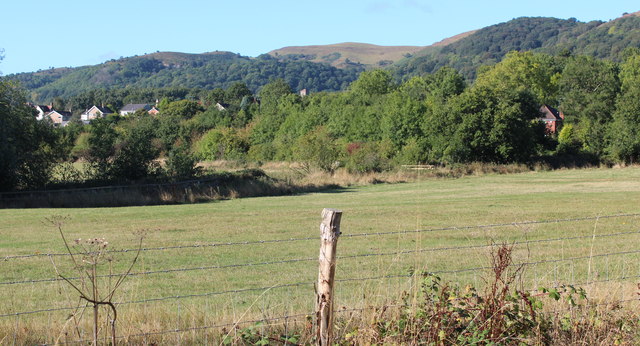
Image: © Bob Embleton Taken: 14 Sep 2011
The meadow is grazed by cattle to maintain the particular ecology of grazed grassland. The houses of Cambridge Close and Chase Road in Upper Welland can be seen on the left with the bell tower of the House of the Good Shepherd, built as a chapel of ease, but now a private house. The un-wooded brown hill in the distance is Millennium Hill, part of the iron age camp known as British Camp. Just below that hill the tower of Little Malvern Priory is visible.
Images are licensed for reuse under creativecommons.org/licenses/by-sa/2.0
Image Location


Leaflet Map data © OpenStreetMap
Latitude
52.069722
Longitude
-2.320616