South wall of Higher Uppacott
Introduction
The photograph on this page of South wall of Higher Uppacott by David Smith as part of the Geograph project.
The Geograph project started in 2005 with the aim of publishing, organising and preserving representative images for every square kilometre of Great Britain, Ireland and the Isle of Man.

There are currently over 7.5m images from over 14,400 individuals and you can help contribute to the project by visiting https://www.geograph.org.uk
South wall of Higher Uppacott
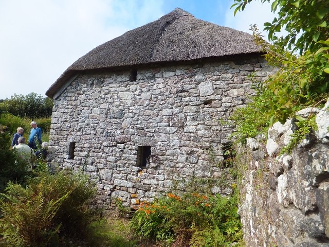
Image: © David Smith Taken: 8 Sep 2011
The Dartmoor National Park Authority owns this grade 1 listed longhouse, which retains many original features. This is the lower end of the longhouse. The drain from the shippon is at the foot of the wall, and below the thatch is a hole for an owl.
Images are licensed for reuse under creativecommons.org/licenses/by-sa/2.0
Image Location
Latitude
50.541136
Longitude
-3.834289