Brier Hey Lane, Mytholmroyd
Introduction
The photograph on this page of Brier Hey Lane, Mytholmroyd by Humphrey Bolton as part of the Geograph project.
The Geograph project started in 2005 with the aim of publishing, organising and preserving representative images for every square kilometre of Great Britain, Ireland and the Isle of Man.

There are currently over 7.5m images from over 14,400 individuals and you can help contribute to the project by visiting https://www.geograph.org.uk
Brier Hey Lane, Mytholmroyd
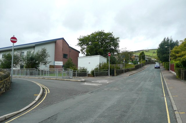
Image: © Humphrey Bolton Taken: 8 Sep 2011
This was a narrow lane from Brier Hey on the main road to a farm and house in grounds called Upper White Lee. The lane was effectively the driveway to the house, but was also a public footpath to Midgley Road (Hebden Royd FP41). The building on the left is the Calder High School Sixth Form and Community Learning Centre.
Images are licensed for reuse under creativecommons.org/licenses/by-sa/2.0
Image Location
Latitude
53.731292
Longitude
-1.97374