Former Church of St Luke, Soulby
Introduction
The photograph on this page of Former Church of St Luke, Soulby by Karl and Ali as part of the Geograph project.
The Geograph project started in 2005 with the aim of publishing, organising and preserving representative images for every square kilometre of Great Britain, Ireland and the Isle of Man.

There are currently over 7.5m images from over 14,400 individuals and you can help contribute to the project by visiting https://www.geograph.org.uk
Former Church of St Luke, Soulby
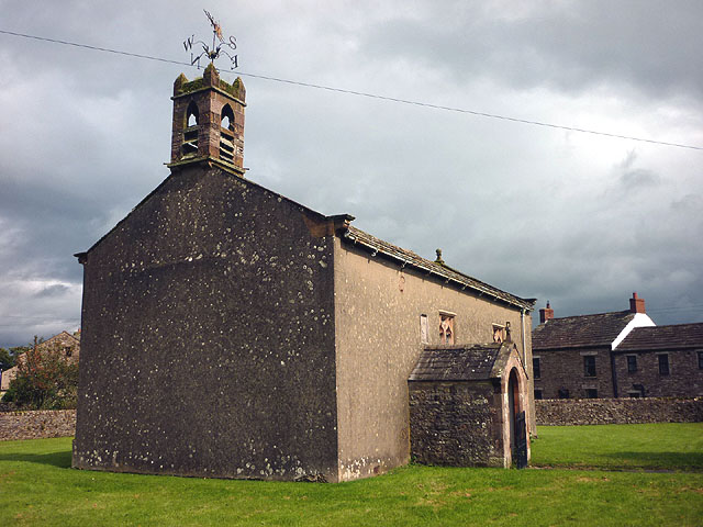
Image: © Karl and Ali Taken: 7 Sep 2011
The church is Grade II listed http://www.britishlistedbuildings.co.uk/en-73027-church-of-st-luke-soulby but appears to be defunct as there is a for sale sign. It was built in 1663 and the 'wrought-iron weathercock has Musgrave arms and 1830 date' although I didn't notice this.
Images are licensed for reuse under creativecommons.org/licenses/by-sa/2.0
Image Location
Latitude
54.494601
Longitude
-2.389797