Bench mark on Pont Adam, Ruabon
Introduction
The photograph on this page of Bench mark on Pont Adam, Ruabon by John S Turner as part of the Geograph project.
The Geograph project started in 2005 with the aim of publishing, organising and preserving representative images for every square kilometre of Great Britain, Ireland and the Isle of Man.

There are currently over 7.5m images from over 14,400 individuals and you can help contribute to the project by visiting https://www.geograph.org.uk
Bench mark on Pont Adam, Ruabon
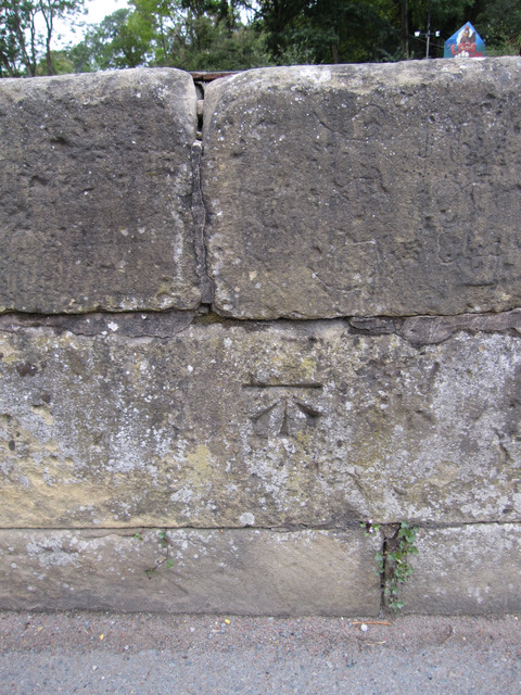
Image: © John S Turner Taken: 10 Sep 2011
This bench mark is on the north parapet of the old stone bridge, Pont Adam, that carries the B5079, also called Pont Adam, over the Afon Eitha. The mark was recorded on the 1874 O.S. map, levelled at 379.5 feet. See also Image]
Images are licensed for reuse under creativecommons.org/licenses/by-sa/2.0
Image Location
Latitude
52.988204
Longitude
-3.044058