Housing development, Hanley Swan
Introduction
The photograph on this page of Housing development, Hanley Swan by Bob Embleton as part of the Geograph project.
The Geograph project started in 2005 with the aim of publishing, organising and preserving representative images for every square kilometre of Great Britain, Ireland and the Isle of Man.

There are currently over 7.5m images from over 14,400 individuals and you can help contribute to the project by visiting https://www.geograph.org.uk
Housing development, Hanley Swan
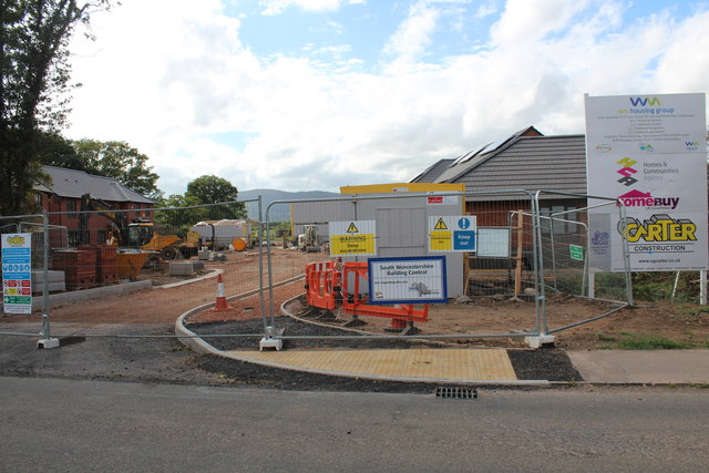
Image: © Bob Embleton Taken: 10 Sep 2011
On the Welland road on what was a meadow between the school and the limit of residential land. There will be 11 new homes for rent or "HomeBuy": 4 three bedroomed houses, 3 two bedroomed houses, 2 two bedroomed bungalows and 2 two bedroomed apartments. Under the "HomeBuy" scheme the occupier initially buys between 25% and 75% of the house with the option of buying more shares in the house later. http://www.homebuy.org.uk/homebuy_schemes.html How the meadow looked in 2007: Image] Image] Image] Image]
Images are licensed for reuse under creativecommons.org/licenses/by-sa/2.0
Image Location
Latitude
52.080621
Longitude
-2.277209