The Jolly Farmers
Introduction
The photograph on this page of The Jolly Farmers by Ian Capper as part of the Geograph project.
The Geograph project started in 2005 with the aim of publishing, organising and preserving representative images for every square kilometre of Great Britain, Ireland and the Isle of Man.

There are currently over 7.5m images from over 14,400 individuals and you can help contribute to the project by visiting https://www.geograph.org.uk
The Jolly Farmers
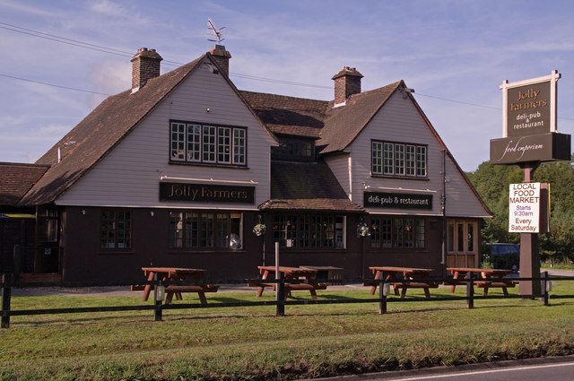
Image: © Ian Capper Taken: 29 Aug 2011
Housed in a 1920s/30s building, it replaces a pub of the same name next door, now a cottage (see Image). It now styles itself as a "deli-pub and restaurant", housing a delicatessen/farm shop as well as a bar and restaurant.
Images are licensed for reuse under creativecommons.org/licenses/by-sa/2.0
Image Location
Latitude
51.243086
Longitude
-0.240287