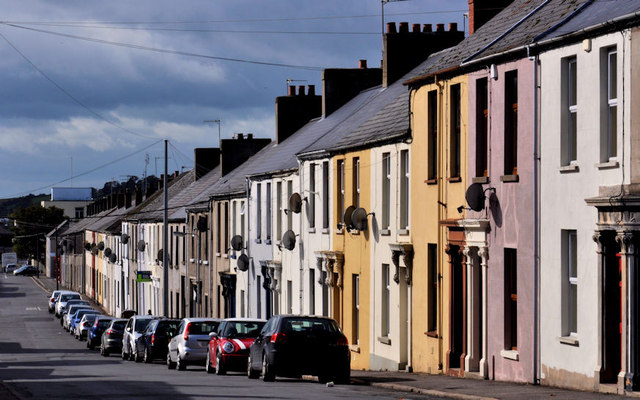
James Street, Newtownards
Introduction
The photograph on this page of James Street, Newtownards by Albert Bridge as part of the Geograph project.
The Geograph project started in 2005 with the aim of publishing, organising and preserving representative images for every square kilometre of Great Britain, Ireland and the Isle of Man.
There are currently over 7.5m images from over 14,400 individuals and you can help contribute to the project by visiting https://www.geograph.org.uk

Image: © Albert Bridge Taken: 9 Sep 2011
Newtownards was planned and built following the Plantation of Ulster and the arrival of settlers from south western Scotland. Sir Hugh Montgomery Image was responsible for the building of the town on the grid pattern. The Plantation Commissioners reported (circa 1611) “Sir Hugh Montgomery hath repaired part of the Abbey . . . . . and made a good town of a hundred houses . . . . all peopled with Scots”. James Street, seen from Talbot Street, is an example of the straight streets of the town centre.

