Parish boundary marker
Introduction
The photograph on this page of Parish boundary marker by Stephen Craven as part of the Geograph project.
The Geograph project started in 2005 with the aim of publishing, organising and preserving representative images for every square kilometre of Great Britain, Ireland and the Isle of Man.

There are currently over 7.5m images from over 14,400 individuals and you can help contribute to the project by visiting https://www.geograph.org.uk
Parish boundary marker
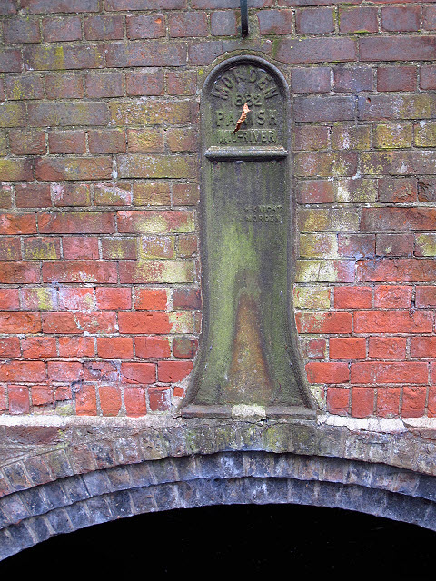
Image: © Stephen Craven Taken: 29 Aug 2011
A cast iron marker on the brick spandrel of London Road bridge over the Wandle - for context see Image and Image The text reads "Morden Parish 1882 mid-river M Knight Morden" (the latter presumably being the ironwright's name). It does still mark the (Anglican parish) boundary - Mitcham to the north and Morden to the south. Civil parishes no longer exist in London.
Images are licensed for reuse under creativecommons.org/licenses/by-sa/2.0
Image Location
Latitude
51.395353
Longitude
-0.173472