Holywell Farm, Upper Town, Wolsingham
Introduction
The photograph on this page of Holywell Farm, Upper Town, Wolsingham by Andrew Curtis as part of the Geograph project.
The Geograph project started in 2005 with the aim of publishing, organising and preserving representative images for every square kilometre of Great Britain, Ireland and the Isle of Man.

There are currently over 7.5m images from over 14,400 individuals and you can help contribute to the project by visiting https://www.geograph.org.uk
Holywell Farm, Upper Town, Wolsingham
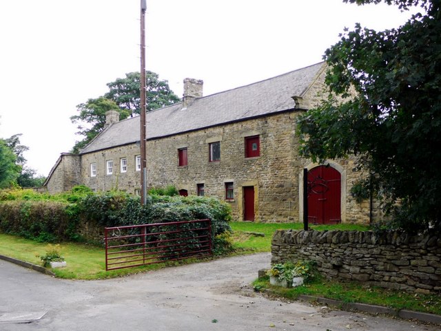
Image: © Andrew Curtis Taken: 2 Sep 2011
A linear farm of the type common in the area. It includes the farmhouse on the left, with neighbouring byre and cart-house dating from the late C17th and a listed building. National Heritage List for England Entry Number: 1276624 https://www.historicengland.org.uk/listing/the-list/list-entry/1276624
Images are licensed for reuse under creativecommons.org/licenses/by-sa/2.0
Image Location
Latitude
54.735748
Longitude
-1.881782