Woolwich ferry approach
Introduction
The photograph on this page of Woolwich ferry approach by Malc McDonald as part of the Geograph project.
The Geograph project started in 2005 with the aim of publishing, organising and preserving representative images for every square kilometre of Great Britain, Ireland and the Isle of Man.

There are currently over 7.5m images from over 14,400 individuals and you can help contribute to the project by visiting https://www.geograph.org.uk
Woolwich ferry approach
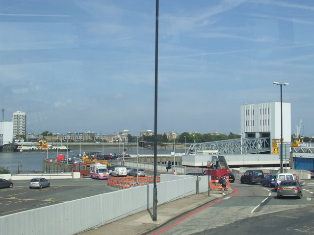
Image: © Malc McDonald Taken: 3 Sep 2011
Downstream from Central London, there are not many places for road traffic to cross the Thames. East of Tower Bridge, the crossings are tunnels (at Rotherhithe, Blackwall and Dartford), a bridge at Dartford and here at Woolwich, a ferry. In this image, cars are queueing for the ferry. The car park to the left of the image is a holding area for when the queues get longer, to try to prevent queueing vehicles from blocking the roads in Woolwich itself. A ferry boat can be seen at the pier on the opposite side of the river, at North Woolwich.
Images are licensed for reuse under creativecommons.org/licenses/by-sa/2.0
Image Location
Latitude
51.493982
Longitude
0.060965