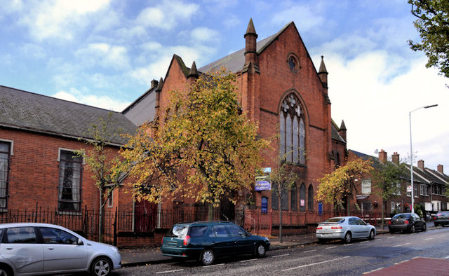
Former Macrory Memorial Presbyterian church, Belfast
Introduction
The photograph on this page of Former Macrory Memorial Presbyterian church, Belfast by Albert Bridge as part of the Geograph project.
The Geograph project started in 2005 with the aim of publishing, organising and preserving representative images for every square kilometre of Great Britain, Ireland and the Isle of Man.
There are currently over 7.5m images from over 14,400 individuals and you can help contribute to the project by visiting https://www.geograph.org.uk

Image: © Albert Bridge Taken: 8 Sep 2011
The former Macrory Memorial Presbyterian church, in Duncairn Gardens, opposite Edlingham Street. It seems to date from 1896 when it replaced one in Gt George’s Street. Currently vacant and with a “to let” sign. My understanding is that an application for planning permission Z/2008/1584/F Construction of a 3-storey building comprising 12no. 2 bedroom apartments with access from both Duncairn Gardens & Hillman Street [amended scheme]” was not approved. Not listed and not on the “at risk” register. Note added 25 November 2011 - there is an application for planning permission, listed under the streamlined procedure, as follows: “Z/2011/1280/F Macrory Memorial Presbyterian Church Duncairn Gardens Belfast BT15 2GN Change of use from church building to 2no hot food takeaways with alterations to front elevation”.

