Bruisyard Church
Introduction
The photograph on this page of Bruisyard Church by Ashley Dace as part of the Geograph project.
The Geograph project started in 2005 with the aim of publishing, organising and preserving representative images for every square kilometre of Great Britain, Ireland and the Isle of Man.

There are currently over 7.5m images from over 14,400 individuals and you can help contribute to the project by visiting https://www.geograph.org.uk
Bruisyard Church
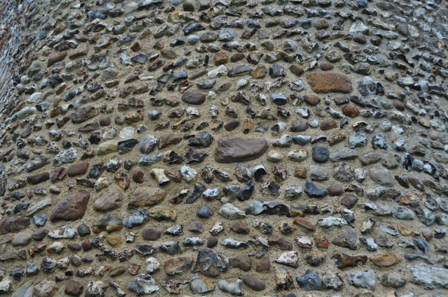
Image: © Ashley Dace Taken: 8 Sep 2011
A closeup of the rubble church tower. Probably the larger stones are glacial erratics. The church is possibly Saxon in date; some believe that the tower was a defensive structure. Other experts agree the flint work is more likely Norman. There is a long blocked Norman doorway on the northern side. See also http://bruisyard.com/parishchurch.aspx
Images are licensed for reuse under creativecommons.org/licenses/by-sa/2.0
Image Location
Latitude
52.245452
Longitude
1.404794