Stryd Tre'r Gof Street
Introduction
The photograph on this page of Stryd Tre'r Gof Street by Eric Jones as part of the Geograph project.
The Geograph project started in 2005 with the aim of publishing, organising and preserving representative images for every square kilometre of Great Britain, Ireland and the Isle of Man.

There are currently over 7.5m images from over 14,400 individuals and you can help contribute to the project by visiting https://www.geograph.org.uk
Stryd Tre'r Gof Street
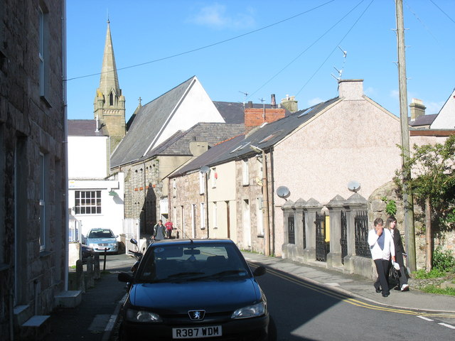
Image: © Eric Jones Taken: 9 Oct 2006
This is a backstreet leading eastwards from Y Maes (Castle Square). The chapel with the spire is Castle Square, the 'English' Presbyterian Chapel (i.e. the services are held in English); and the white building (left) is the old sorting office at the back of the Post Office.
Images are licensed for reuse under creativecommons.org/licenses/by-sa/2.0
Image Location


Leaflet Map data © OpenStreetMap
Latitude
53.138811
Longitude
-4.273774