Disused railway, Legatiriff near Glenavy (2)
Introduction
The photograph on this page of Disused railway, Legatiriff near Glenavy (2) by Albert Bridge as part of the Geograph project.
The Geograph project started in 2005 with the aim of publishing, organising and preserving representative images for every square kilometre of Great Britain, Ireland and the Isle of Man.

There are currently over 7.5m images from over 14,400 individuals and you can help contribute to the project by visiting https://www.geograph.org.uk
Disused railway, Legatiriff near Glenavy (2)
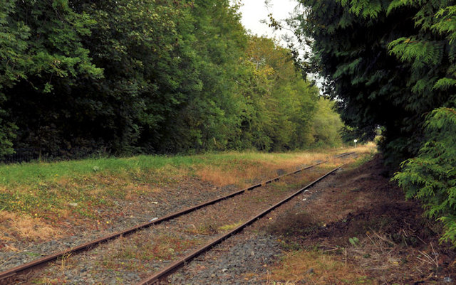
Image: © Albert Bridge Taken: 7 Sep 2011
The “mothballed” Lisburn – Antrim line (looking towards Antrim) at accommodation crossing no XA345 beside the Scroggy Road (out of picture to the right), south of Glenavy. Note: the townland is “Legatirriff” but the railway spelling has always been “Legatiriff”.
Images are licensed for reuse under creativecommons.org/licenses/by-sa/2.0
Image Location
Latitude
54.565039
Longitude
-6.216055