Chapel Walls Well, Wolsingham
Introduction
The photograph on this page of Chapel Walls Well, Wolsingham by Andrew Curtis as part of the Geograph project.
The Geograph project started in 2005 with the aim of publishing, organising and preserving representative images for every square kilometre of Great Britain, Ireland and the Isle of Man.

There are currently over 7.5m images from over 14,400 individuals and you can help contribute to the project by visiting https://www.geograph.org.uk
Chapel Walls Well, Wolsingham
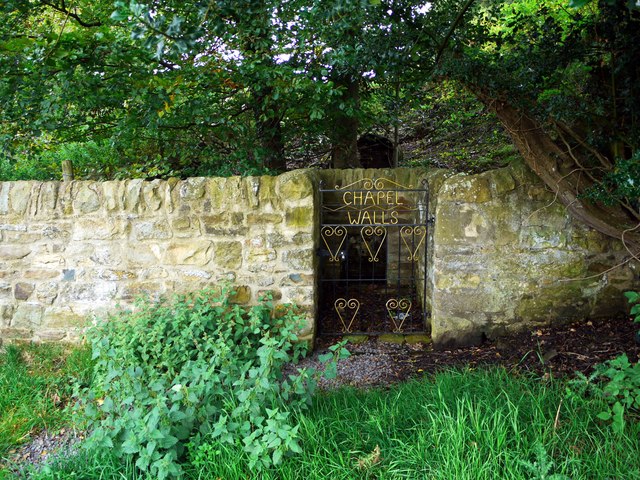
Image: © Andrew Curtis Taken: 2 Sep 2011
Near the well are the remains of a moated manor house dating to the C12th but there is little to see above ground http://www.pastscape.org.uk/hob.aspx?hob_id=20090 Earthworks existing in the field immediately south of the well are thought to be part of a medieval settlement (either a village or part of the manor house) Image It has also been associated with remains of a failed monastic foundation documented in the C12th. Keys to the Past: http://www.keystothepast.info/article/10339/site-Details?PRN=D9123 Gatehouse: http://www.gatehouse-gazetteer.info/English%20sites/4482.html
Images are licensed for reuse under creativecommons.org/licenses/by-sa/2.0
Image Location
Latitude
54.733951
Longitude
-1.882719