
Easter Road
Introduction
The photograph on this page of Easter Road by kim traynor as part of the Geograph project.
The Geograph project started in 2005 with the aim of publishing, organising and preserving representative images for every square kilometre of Great Britain, Ireland and the Isle of Man.

There are currently over 7.5m images from over 14,400 individuals and you can help contribute to the project by visiting https://www.geograph.org.uk
Easter Road
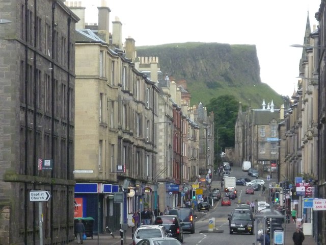
Image: © kim traynor Taken: 25 Aug 2011
Looking southwards with Salisbury Crags rising in the distance. In the days when small children were allowed to roam freely, Arthur's Seat beckoned the young of this most densely populated part of Edinburgh to their own Shangri-la of a play area in the King's Park. This was originally the old coach road between Edinburgh and Leith. http://en.wikipedia.org/wiki/File:Easter_Road_between_Edinburgh_and_Leith_in_the_18th_century.jpg "In 1763—There were two stage-coaches, with three horses, a coachman, and postillion to each coach, which went to the port of Leith (a mile and a half distant) every hour from eight in the morning, till eight at night, and consumed a full hour upon the road. In 1783—There were five or six stagecoaches to Leith every half-hour, which ran it in fifteen minutes." (from a letter by the publisher William Creech in The Statistical Account of Scotland, 1791-99)
Images are licensed for reuse under creativecommons.org/licenses/by-sa/2.0
Image Location

Latitude
55.958747
Longitude
-3.171924