England in view
Introduction
The photograph on this page of England in view by Jim Barton as part of the Geograph project.
The Geograph project started in 2005 with the aim of publishing, organising and preserving representative images for every square kilometre of Great Britain, Ireland and the Isle of Man.

There are currently over 7.5m images from over 14,400 individuals and you can help contribute to the project by visiting https://www.geograph.org.uk
England in view
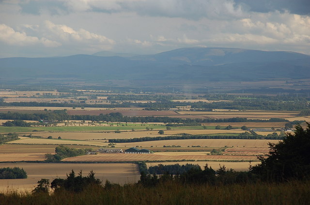
Image: © Jim Barton Taken: 4 Sep 2011
The blue-grey mass of The Cheviot (815m) is about 40km away across the flat plain known as the Merse, seen from Langton Edge above Duns. Wark is about half way across in the centre of this long range view.
Images are licensed for reuse under creativecommons.org/licenses/by-sa/2.0
Image Location
Latitude
55.640631
Longitude
-2.280527