Top or Upper?
Introduction
The photograph on this page of Top or Upper? by Alan Murray-Rust as part of the Geograph project.
The Geograph project started in 2005 with the aim of publishing, organising and preserving representative images for every square kilometre of Great Britain, Ireland and the Isle of Man.

There are currently over 7.5m images from over 14,400 individuals and you can help contribute to the project by visiting https://www.geograph.org.uk
Top or Upper?
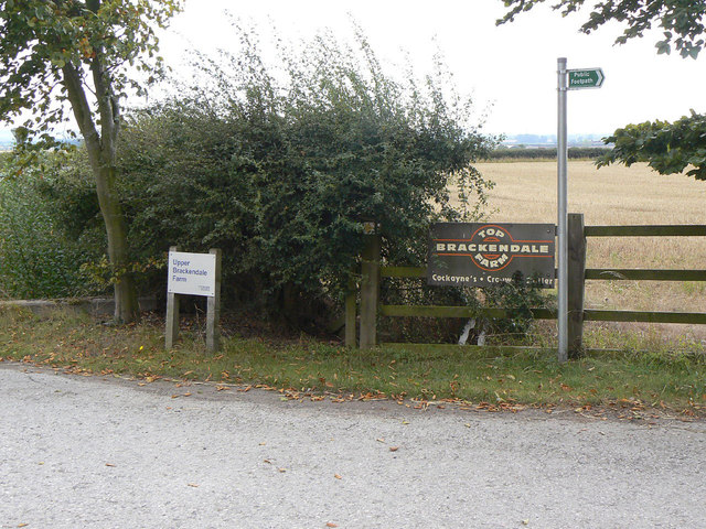
Image: © Alan Murray-Rust Taken: 2 Sep 2011
The two signs have different names, but maps consistently show Top Brackendale Farm. The farm has been part of the Crown Estate since 1925, with the Cockayne family as tenant farmers, but it seems that the Crown Estate has only started installing its own name plates in recent times. The name Brackendale stems from the name of the old medieval open field on this side of Bingham.
Images are licensed for reuse under creativecommons.org/licenses/by-sa/2.0
Image Location
Latitude
52.944186
Longitude
-0.959003