The Oast House, Bury St. Edmunds
Introduction
The photograph on this page of The Oast House, Bury St. Edmunds by John Goldsmith as part of the Geograph project.
The Geograph project started in 2005 with the aim of publishing, organising and preserving representative images for every square kilometre of Great Britain, Ireland and the Isle of Man.

There are currently over 7.5m images from over 14,400 individuals and you can help contribute to the project by visiting https://www.geograph.org.uk
The Oast House, Bury St. Edmunds
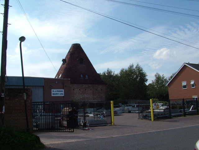
Image: © John Goldsmith Taken: 2 Sep 2011
Oast houses are normally associated mainly with Kent, and I had lived in Bury St. Edmunds for decades before I discovered that we have one in the town. It has obviously been converted to housing and/or offices. In the foreground we see a storage yard for a builders' merchants.
Images are licensed for reuse under creativecommons.org/licenses/by-sa/2.0
Image Location
Latitude
52.239081
Longitude
0.722079