Fencehouses level crossing
Introduction
The photograph on this page of Fencehouses level crossing by Malc McDonald as part of the Geograph project.
The Geograph project started in 2005 with the aim of publishing, organising and preserving representative images for every square kilometre of Great Britain, Ireland and the Isle of Man.

There are currently over 7.5m images from over 14,400 individuals and you can help contribute to the project by visiting https://www.geograph.org.uk
Fencehouses level crossing
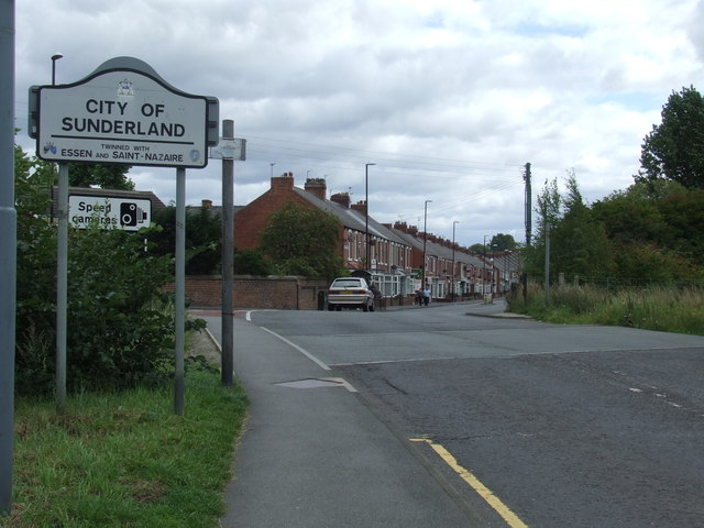
Image: © Malc McDonald Taken: 29 Aug 2011
The change in the road surface marks the site of a railway level crossing. The railway through Fencehouses fell into disuse in around 1992. The line is still "mothballed", retained by Network Rail in case there is a need to bring it back into use in future. In many places the track is intact, but it would need to be restored at this point. The railway also marks the boundary between County Durham (this side of the crossing) and Tyne & Wear on the far side.
Images are licensed for reuse under creativecommons.org/licenses/by-sa/2.0
Image Location
Latitude
54.846144
Longitude
-1.506157