Bay of Nigg
Introduction
The photograph on this page of Bay of Nigg by Colin Smith as part of the Geograph project.
The Geograph project started in 2005 with the aim of publishing, organising and preserving representative images for every square kilometre of Great Britain, Ireland and the Isle of Man.

There are currently over 7.5m images from over 14,400 individuals and you can help contribute to the project by visiting https://www.geograph.org.uk
Bay of Nigg
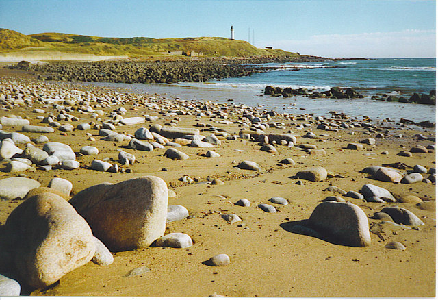
Image: © Colin Smith Taken: Unknown
Rocks rounded by the sea are common on the sand at Nigg. In the distance is Girdleness lighthouse. In the geological past, Nigg Bay was the rivermouth of the Dee - it now reaches the sea to the north of Girdleness.
Images are licensed for reuse under creativecommons.org/licenses/by-sa/2.0
Image Location
Latitude
57.1332
Longitude
-2.057803