South Harbour, Ayr
Introduction
The photograph on this page of South Harbour, Ayr by Mary and Angus Hogg as part of the Geograph project.
The Geograph project started in 2005 with the aim of publishing, organising and preserving representative images for every square kilometre of Great Britain, Ireland and the Isle of Man.

There are currently over 7.5m images from over 14,400 individuals and you can help contribute to the project by visiting https://www.geograph.org.uk
South Harbour, Ayr
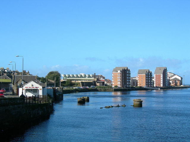
Image: © Mary and Angus Hogg Taken: 9 Oct 2006
New housing development on the site of the old fish quay, with The Citadel Leisure Centre to the left. The only boat in the South Harbour now is The Coffee Boat. The piers in the river belong to a former railway bridge which carried a spur line from the original railway station on the north bank to the quayside on the south bank. (Source: "Discovering Ayrshire", by John Strawhorn & Ken Andrew).
Images are licensed for reuse under creativecommons.org/licenses/by-sa/2.0
Image Location
Latitude
55.467914
Longitude
-4.635386