Former Infirmary Block, Wharfedale General Hospital
Introduction
The photograph on this page of Former Infirmary Block, Wharfedale General Hospital by Derek Harper as part of the Geograph project.
The Geograph project started in 2005 with the aim of publishing, organising and preserving representative images for every square kilometre of Great Britain, Ireland and the Isle of Man.

There are currently over 7.5m images from over 14,400 individuals and you can help contribute to the project by visiting https://www.geograph.org.uk
Former Infirmary Block, Wharfedale General Hospital
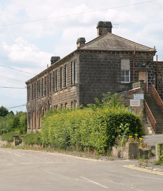
Image: © Derek Harper Taken: 28 Jul 2011
Seen from Newall Carr Road. This was built in 1871-3 as the Infirmary block of the Wharfedale Union Workhouse or the Poor Law Union http://www.britishlistedbuildings.co.uk/en-486873-former-infirmary-block-and-retaining-wal . The new hospital is shown in Image
Images are licensed for reuse under creativecommons.org/licenses/by-sa/2.0
Image Location
Latitude
53.915259
Longitude
-1.698675