Glynneath : The Lamb and Flag viewed from the east
Introduction
The photograph on this page of Glynneath : The Lamb and Flag viewed from the east by Jaggery as part of the Geograph project.
The Geograph project started in 2005 with the aim of publishing, organising and preserving representative images for every square kilometre of Great Britain, Ireland and the Isle of Man.

There are currently over 7.5m images from over 14,400 individuals and you can help contribute to the project by visiting https://www.geograph.org.uk
Glynneath : The Lamb and Flag viewed from the east
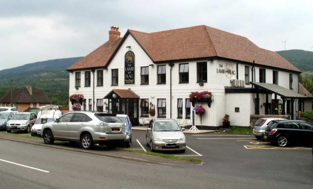
Image: © Jaggery Taken: 31 Jul 2011
Early 19th-century inn located on the corner of the B4242 and Morfa Glas. The facilities available shown on the name board are "Pub and restaurant with guest rooms". So it's still an inn! The Lamb and Flag was rebuilt after a devastating fire in November 2008. This http://www.geograph.org.uk/photo/612956 is how it looked in 2005. http://www.geograph.org.uk/photo/2578398 to a view from the west.
Images are licensed for reuse under creativecommons.org/licenses/by-sa/2.0
Image Location
Latitude
51.743152
Longitude
-3.632278