Bridge House and neighbour
Introduction
The photograph on this page of Bridge House and neighbour by Roger Jones as part of the Geograph project.
The Geograph project started in 2005 with the aim of publishing, organising and preserving representative images for every square kilometre of Great Britain, Ireland and the Isle of Man.

There are currently over 7.5m images from over 14,400 individuals and you can help contribute to the project by visiting https://www.geograph.org.uk
Bridge House and neighbour
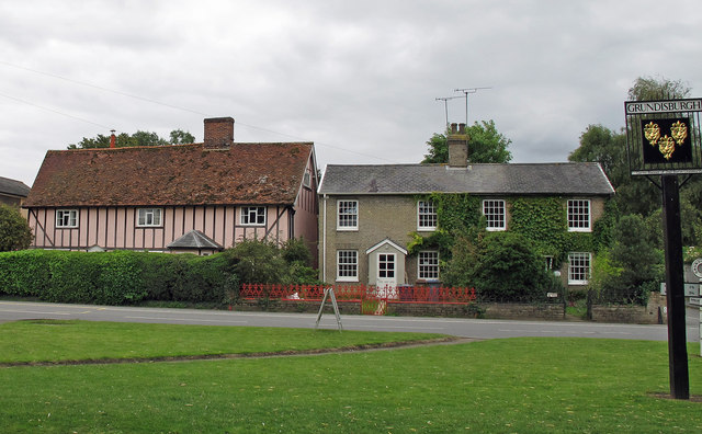
Image: © Roger Jones Taken: 29 Aug 2011
Bridge house (on the left): GV II House. C17. Timber framed with brick and colourwashed rendered infill and a plain tiled roof, originally thatched. See http://www.britishlistedbuildings.co.uk/en-285447-bridge-house-grundisburgh
Images are licensed for reuse under creativecommons.org/licenses/by-sa/2.0
Image Location
Latitude
52.112304
Longitude
1.246645