Whitehawk
Introduction
The photograph on this page of Whitehawk by Simon Carey as part of the Geograph project.
The Geograph project started in 2005 with the aim of publishing, organising and preserving representative images for every square kilometre of Great Britain, Ireland and the Isle of Man.

There are currently over 7.5m images from over 14,400 individuals and you can help contribute to the project by visiting https://www.geograph.org.uk
Whitehawk
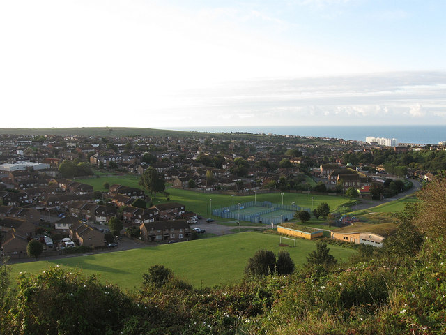
Image: © Simon Carey Taken: 29 Aug 2011
Large estate on the eastern edge of Brighton viewed from Race Hill which up to the end of the eighteenth century was known as Whitehawk Down with the valley called Whitehawk Bottom. Built as a large council estate between 1933-37 to house those removed from the slum clearances simultaneously occurring in the centre of town. The estate was rebuilt in the 1970s rearranging the former wide sweeping roads with small cul-de-sacs, many former roads disappeared or are truncated like Whitehawk Road to the right beyond the sports pavilion which originally continued northwards. Red Hill is to the left on the other side of the valley whilst the large white building to the right is Marine Gate which overlooks Brighton Marina.
Images are licensed for reuse under creativecommons.org/licenses/by-sa/2.0
Image Location
Latitude
50.829444
Longitude
-0.107182