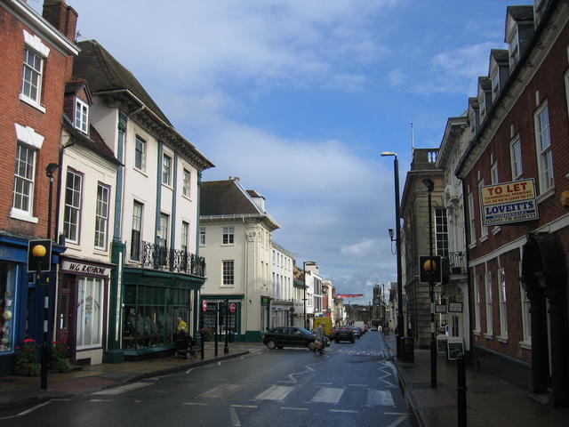
Warwick crossroads
Introduction
The photograph on this page of Warwick crossroads by David Stowell as part of the Geograph project.
The Geograph project started in 2005 with the aim of publishing, organising and preserving representative images for every square kilometre of Great Britain, Ireland and the Isle of Man.
There are currently over 7.5m images from over 14,400 individuals and you can help contribute to the project by visiting https://www.geograph.org.uk

Image: © David Stowell Taken: 6 Oct 2006
Looking east along Jury Street at the point that used to be the main crossroads at the centre of Warwick. Church Street to the left led to the town's north gate and thence the road towards Birmingham. The Image protrudes slightly on the right and marks the corner of Image that at one time continued directly in front of Warwick Castle and led to the original medieval bridge Image, and thence the high road to Banbury. In the distance the tower of Image can be seen. The two three storeyed buildings on the left flanking the junction with Church Street along with the one on the right just before Castle Street and the Court House are of similar designs with matching cornices and pilasters of Corinthian, Ionic and Doric orders. Their design was ordered by the Fire Commissioners after the original buildings were destroyed in the Great Fire in 1694. Most other replacement buildings were limited to two floors however these were allowed to have three storeys due to their prominent position.

