
Trig pillar on Cilifor Top
Introduction
The photograph on this page of Trig pillar on Cilifor Top by Nigel Davies as part of the Geograph project.
The Geograph project started in 2005 with the aim of publishing, organising and preserving representative images for every square kilometre of Great Britain, Ireland and the Isle of Man.

There are currently over 7.5m images from over 14,400 individuals and you can help contribute to the project by visiting https://www.geograph.org.uk
Trig pillar on Cilifor Top
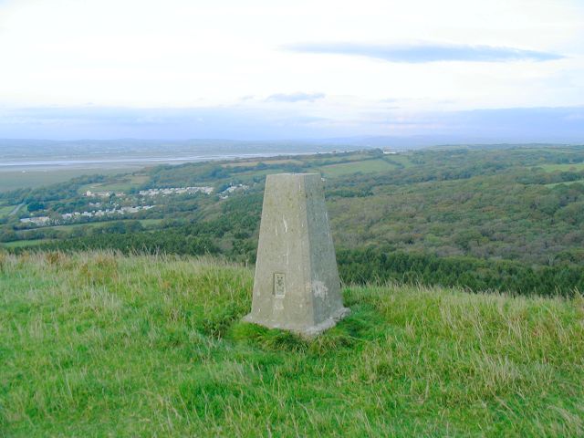
Image: © Nigel Davies Taken: 10 Oct 2006
Cilifor Top is a small hill with steep slopes on all sides except for the south approach. It used to be a fort and you can still see where a bank has been built up on the southwest edge to augment the natural defences. Now this trig point is the only construction on the grazing land. It offers an exceptional panorama - taking in the hills at the northwest of the gower peninsula, around through Carmarthen Bay, the Llanelli coastline, Loughor estuary and mountains in the Beacons national park. Despite the absence of any markings on the OS 25k & 50k maps, there is a permissive path onto this hill.
Images are licensed for reuse under creativecommons.org/licenses/by-sa/2.0
Image Location

Latitude
51.610553
Longitude
-4.159016