Eastry chalk caves
Introduction
The photograph on this page of Eastry chalk caves by Nick Smith as part of the Geograph project.
The Geograph project started in 2005 with the aim of publishing, organising and preserving representative images for every square kilometre of Great Britain, Ireland and the Isle of Man.

There are currently over 7.5m images from over 14,400 individuals and you can help contribute to the project by visiting https://www.geograph.org.uk
Eastry chalk caves
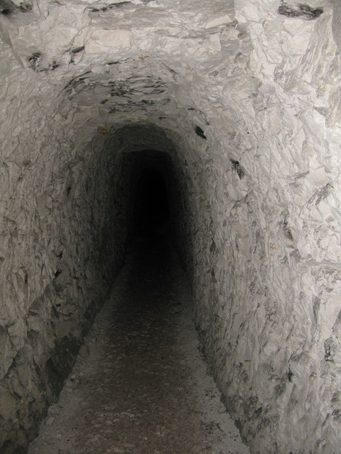
Image: © Nick Smith Taken: 20 May 2009
Exact location and view direction very difficult to estimate. Somewhere under Eastry village hall or car park! Eastry Chalk Mine was started in 1811 for a lime burning business and remained in production until 1914. Mining ceased when local villagers began to voice their concerns that their properties were in danger of collapse because of the mining beneath them. The tunnels were then used to hold local festivities. See http://www.undergroundkent.co.uk/eastrymine.htm
Images are licensed for reuse under creativecommons.org/licenses/by-sa/2.0
Image Location
Latitude
51.247499
Longitude
1.307003