Eton College
Introduction
The photograph on this page of Eton College by Darren Smith as part of the Geograph project.
The Geograph project started in 2005 with the aim of publishing, organising and preserving representative images for every square kilometre of Great Britain, Ireland and the Isle of Man.

There are currently over 7.5m images from over 14,400 individuals and you can help contribute to the project by visiting https://www.geograph.org.uk
Eton College
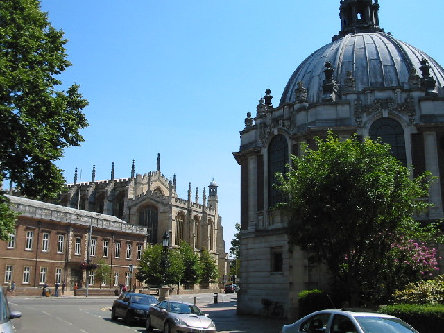
Image: © Darren Smith Taken: 10 Jul 2005
This photo shows the Eton College Library on the right (the domed building), the College chapel in the centre, and the original College building on the left. Most of this square is taken up with Eton and Eton Brocas (the fields to the west of Eton by the river).
Images are licensed for reuse under creativecommons.org/licenses/by-sa/2.0
Image Location


Leaflet Map data © OpenStreetMap
Latitude
51.491821
Longitude
-0.611416