Western edge of Gaer Vale, Newport
Introduction
The photograph on this page of Western edge of Gaer Vale, Newport by Jaggery as part of the Geograph project.
The Geograph project started in 2005 with the aim of publishing, organising and preserving representative images for every square kilometre of Great Britain, Ireland and the Isle of Man.

There are currently over 7.5m images from over 14,400 individuals and you can help contribute to the project by visiting https://www.geograph.org.uk
Western edge of Gaer Vale, Newport
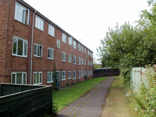
Image: © Jaggery Taken: 23 Aug 2011
Gaer Vale is an area of houses and flats located between Cardiff Road and a single-track railway line. The railway fence can be seen on the right. Ahead are flats numbered 143-154. The path along the NW edge of Gaer Vale ends at the wall at the far end of the flats.
Images are licensed for reuse under creativecommons.org/licenses/by-sa/2.0
Image Location
Latitude
51.571155
Longitude
-3.017183