Parker Long House
Introduction
The photograph on this page of Parker Long House by Roger Jones as part of the Geograph project.
The Geograph project started in 2005 with the aim of publishing, organising and preserving representative images for every square kilometre of Great Britain, Ireland and the Isle of Man.

There are currently over 7.5m images from over 14,400 individuals and you can help contribute to the project by visiting https://www.geograph.org.uk
Parker Long House
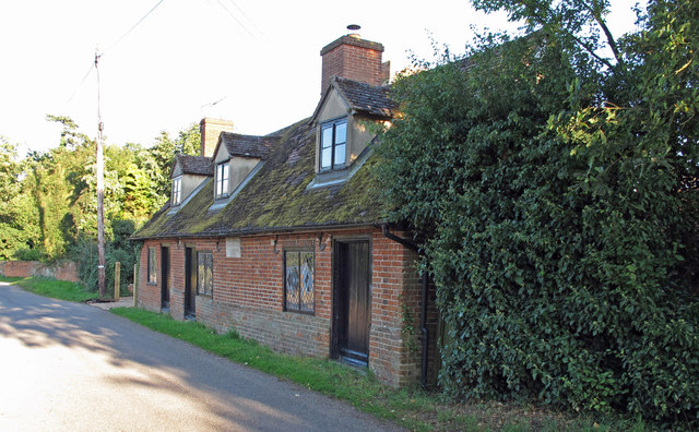
Image: © Roger Jones Taken: 21 Aug 2011
Originally 3 almshouses. Dated 1740. Stone plaque reads: The Gift of Sir Philip Parker Long Bart, to the poor of Erwarton, 1740 See also: https://historicengland.org.uk/listing/the-list/list-entry/1036905
Images are licensed for reuse under creativecommons.org/licenses/by-sa/2.0
Image Location
Latitude
51.966394
Longitude
1.230897