Cycle route along an old railway line
Introduction
The photograph on this page of Cycle route along an old railway line by Hywel Williams as part of the Geograph project.
The Geograph project started in 2005 with the aim of publishing, organising and preserving representative images for every square kilometre of Great Britain, Ireland and the Isle of Man.

There are currently over 7.5m images from over 14,400 individuals and you can help contribute to the project by visiting https://www.geograph.org.uk
Cycle route along an old railway line
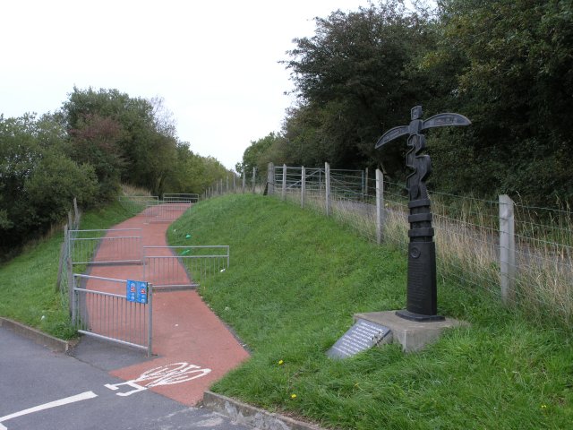
Image: © Hywel Williams Taken: 8 Oct 2006
This is part of Sustrans national cycle route 47 which at this stage follows an abandoned railway line for several miles. A Dudgen type mile post (one of only two of this type in Wales) can be seen giving directions to Llanelli and Porthyrhyd. The plaque in front of the post is a Welsh translation of some English text on the post.
Images are licensed for reuse under creativecommons.org/licenses/by-sa/2.0
Image Location


Leaflet Map data © OpenStreetMap
Latitude
51.786654
Longitude
-4.118119