Cycle path near St Werburghs Road Metrolink station, Chorlton
Introduction
The photograph on this page of Cycle path near St Werburghs Road Metrolink station, Chorlton by Phil Champion as part of the Geograph project.
The Geograph project started in 2005 with the aim of publishing, organising and preserving representative images for every square kilometre of Great Britain, Ireland and the Isle of Man.

There are currently over 7.5m images from over 14,400 individuals and you can help contribute to the project by visiting https://www.geograph.org.uk
Cycle path near St Werburghs Road Metrolink station, Chorlton
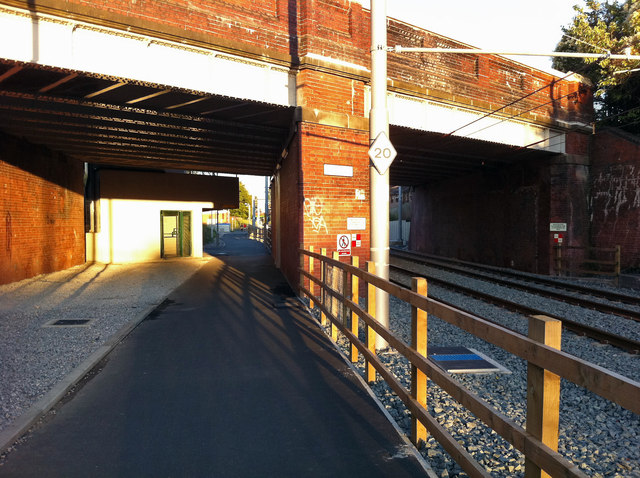
Image: © Phil Champion Taken: 4 Aug 2011
Opened to St Werburghs Road in July 2011, the South Manchester Metrolink line utilises the trackbed of the Midland Railway's South Manchester District Line. At Chorlton Junction, where the tram station now stands on the opposite side of the bridge, the former Manchester Sheffield & Lincolnshire Railway's Falowfield Loop Line towards Guide Bridge diverged from the South District Line. In the 1990s the Fallowfield Loop was converted into a cycle path, which also continued under the bridge span seen on the right hand side for a short distance. Fortunately the bridge had been built to accommodate future doubling between Chorlton-cum-Hardy station and Chorlton Junction (which did not take place). This has allowed the cycle path to be diverted through the unused span, crossing the tram tracks a little way to the west.
Images are licensed for reuse under creativecommons.org/licenses/by-sa/2.0
Image Location
Latitude
53.439415
Longitude
-2.267315