Methodist Church and Bed & Breakfast
Introduction
The photograph on this page of Methodist Church and Bed & Breakfast by Des Blenkinsopp as part of the Geograph project.
The Geograph project started in 2005 with the aim of publishing, organising and preserving representative images for every square kilometre of Great Britain, Ireland and the Isle of Man.

There are currently over 7.5m images from over 14,400 individuals and you can help contribute to the project by visiting https://www.geograph.org.uk
Methodist Church and Bed & Breakfast
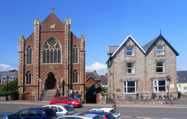
Image: © Des Blenkinsopp Taken: 31 May 2011
Both these buildings are featured individually from other contributors, but I like this pic. of them both together, contrasting brick and stone but with the same pointy rooflines. The church dates from 1871. The bed and breakfast is actually two separate units called Ratcliffe House (L) and Ivy House (Rt)
Images are licensed for reuse under creativecommons.org/licenses/by-sa/2.0
Image Location


Leaflet Map data © OpenStreetMap
Latitude
51.181185
Longitude
-3.32977