No 83, West End
Introduction
The photograph on this page of No 83, West End by Mike Kirby as part of the Geograph project.
The Geograph project started in 2005 with the aim of publishing, organising and preserving representative images for every square kilometre of Great Britain, Ireland and the Isle of Man.

There are currently over 7.5m images from over 14,400 individuals and you can help contribute to the project by visiting https://www.geograph.org.uk
No 83, West End
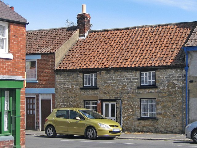
Image: © Mike Kirby Taken: 9 Jul 2011
A grade II listed 1½-storey house from the early/mid C18, with earlier origins. Built in coursed rubble sandstone, partly cruck-framed, and with a single chimney stack to the left of a steeply-pitched pantile roof. LBS No: 328432
Images are licensed for reuse under creativecommons.org/licenses/by-sa/2.0
Image Location
Latitude
54.26842
Longitude
-0.935644