The Mount (Calvary)
Introduction
The photograph on this page of The Mount (Calvary) by Simon Carey as part of the Geograph project.
The Geograph project started in 2005 with the aim of publishing, organising and preserving representative images for every square kilometre of Great Britain, Ireland and the Isle of Man.

There are currently over 7.5m images from over 14,400 individuals and you can help contribute to the project by visiting https://www.geograph.org.uk
The Mount (Calvary)
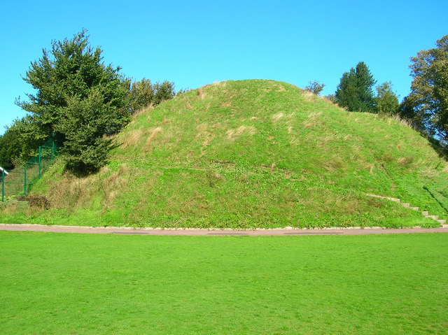
Image: © Simon Carey Taken: 7 Oct 2006
A former defensive mound given to St Pancras' Priory in 1077 when the land on which this stands was given over to the Cluniac order and William de Warenne decided to build himself a castle further up the hill. Stories are also told that the mound was used as a Calvary hill when monks out of penance had to walk up to the top with a cross over their shoulder, though a more realistic story appears to be that it was the home to the priory's windmill. Crosses are still taken to the top of the mound on Good Friday along the spiral pathway which can be made out though the mound has lost part of the left hand side when the bowling club cut a chunk out in order to build a bowling green during the Victorian era.
Images are licensed for reuse under creativecommons.org/licenses/by-sa/2.0
Image Location


Leaflet Map data © OpenStreetMap
Latitude
50.868593
Longitude
0.009523