Tanners Brook
Introduction
The photograph on this page of Tanners Brook by Simon Carey as part of the Geograph project.
The Geograph project started in 2005 with the aim of publishing, organising and preserving representative images for every square kilometre of Great Britain, Ireland and the Isle of Man.

There are currently over 7.5m images from over 14,400 individuals and you can help contribute to the project by visiting https://www.geograph.org.uk
Tanners Brook
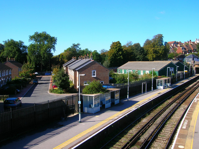
Image: © Simon Carey Taken: 7 Oct 2006
Is the name of the cul-de-sac on the left hand side of the picture. It was built on the site of the old cattle market in the 1990s. The green buildings to the right are also from the former cattle market and are now used as auction rooms. In the foreground are platforms 1 and 2 of Lewes station on the line that links Lewes with the main London-Brighton line between Burgess Hill and Wivelsfield.
Images are licensed for reuse under creativecommons.org/licenses/by-sa/2.0
Image Location
Latitude
50.87039
Longitude
0.0096