No?s 17 & 19, Piercy End
Introduction
The photograph on this page of No?s 17 & 19, Piercy End by Mike Kirby as part of the Geograph project.
The Geograph project started in 2005 with the aim of publishing, organising and preserving representative images for every square kilometre of Great Britain, Ireland and the Isle of Man.

There are currently over 7.5m images from over 14,400 individuals and you can help contribute to the project by visiting https://www.geograph.org.uk
No?s 17 & 19, Piercy End
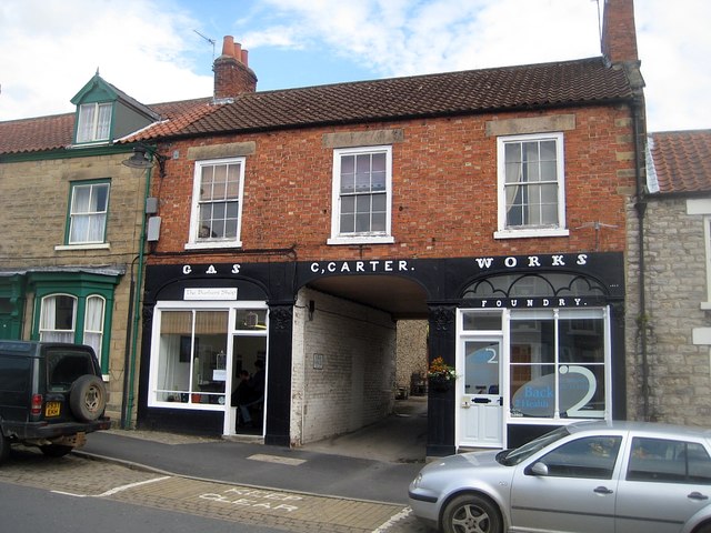
Image: © Mike Kirby Taken: 9 Jul 2011
Nos 17, left of arch, and No 19, form a grade II listed building dated late C18, remodelled in 1863. Now shops, the former ironworks was built in brick with ashlar quoins, and a pantile roof with brick stacks. The carriage arch leads through to where the workshops of the ironworks were located. The 2 shop fronts are framed in moulded cast-iron pilasters and the words 'GAS', 'WORKS' and 'FOUNDRY' are cast into iron panels. LBS No: 328420
Images are licensed for reuse under creativecommons.org/licenses/by-sa/2.0
Image Location
Latitude
54.268652
Longitude
-0.930448