Kirk Sandall Junction
Introduction
The photograph on this page of Kirk Sandall Junction by Jonathan Thacker as part of the Geograph project.
The Geograph project started in 2005 with the aim of publishing, organising and preserving representative images for every square kilometre of Great Britain, Ireland and the Isle of Man.

There are currently over 7.5m images from over 14,400 individuals and you can help contribute to the project by visiting https://www.geograph.org.uk
Kirk Sandall Junction
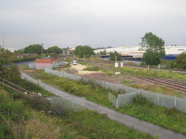
Image: © Jonathan Thacker Taken: 6 Aug 2011
The main line (to the left of the brick building) is the former South Yorkshire Railway and River Dun Navigation Company line of 1866. The lines to the right of the fence serve a local factory and the line furthest from the camera on the right of the picture is the South Yorkshire Joint railway line of 1900 which acted as a Doncaster station avoiding line for freight traffic coming from collieries to the south of Doncaster.
Images are licensed for reuse under creativecommons.org/licenses/by-sa/2.0
Image Location
Latitude
53.559084
Longitude
-1.084371