Information board at the edge of Walton Moss
Introduction
The photograph on this page of Information board at the edge of Walton Moss by Rose and Trev Clough as part of the Geograph project.
The Geograph project started in 2005 with the aim of publishing, organising and preserving representative images for every square kilometre of Great Britain, Ireland and the Isle of Man.

There are currently over 7.5m images from over 14,400 individuals and you can help contribute to the project by visiting https://www.geograph.org.uk
Information board at the edge of Walton Moss
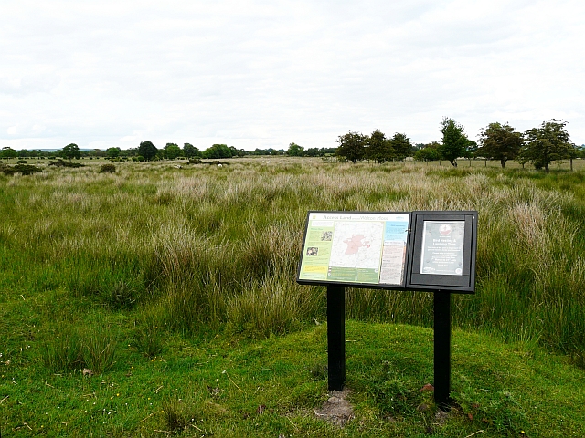
Image: © Rose and Trev Clough Taken: 15 Jun 2008
There is a map of Access Land in the area, and information about the moss. The larger area of Walton Moss (to the north west) is an actively growing raised mire, a rare survivor in Britain of this type of lowland peat bog. The land seen behind the board, however, has been subject to drainage and the sphagum moss has given way to grass, rush and scrub.
Images are licensed for reuse under creativecommons.org/licenses/by-sa/2.0
Image Location
Latitude
54.986939
Longitude
-2.7593