Fleck Lane
Introduction
The photograph on this page of Fleck Lane by J Scott as part of the Geograph project.
The Geograph project started in 2005 with the aim of publishing, organising and preserving representative images for every square kilometre of Great Britain, Ireland and the Isle of Man.

There are currently over 7.5m images from over 14,400 individuals and you can help contribute to the project by visiting https://www.geograph.org.uk
Fleck Lane
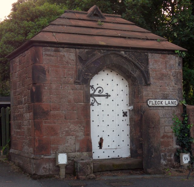
Image: © J Scott Taken: 4 Aug 2011
Former Well house constructed mid 19th Century. Used to store water before the opening of water works, 1877 on Column Road.
Images are licensed for reuse under creativecommons.org/licenses/by-sa/2.0
Image Location
Latitude
53.366799
Longitude
-3.164358