Near Cruden Bay
Introduction
The photograph on this page of Near Cruden Bay by Anne Burgess as part of the Geograph project.
The Geograph project started in 2005 with the aim of publishing, organising and preserving representative images for every square kilometre of Great Britain, Ireland and the Isle of Man.

There are currently over 7.5m images from over 14,400 individuals and you can help contribute to the project by visiting https://www.geograph.org.uk
Near Cruden Bay
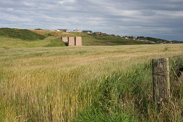
Image: © Anne Burgess Taken: 5 Aug 2011
A field of barley, accessed by a gateway which has not had a gate for some time. The three bits of masonry in the distance were once supports for the long-vanished railway line. Beyond it are some of the newer houses on the outskirts of the village of Cruden Bay.
Images are licensed for reuse under creativecommons.org/licenses/by-sa/2.0
Image Location
Latitude
57.420316
Longitude
-1.859133