Caldy Village Memorial
Introduction
The photograph on this page of Caldy Village Memorial by J Scott as part of the Geograph project.
The Geograph project started in 2005 with the aim of publishing, organising and preserving representative images for every square kilometre of Great Britain, Ireland and the Isle of Man.

There are currently over 7.5m images from over 14,400 individuals and you can help contribute to the project by visiting https://www.geograph.org.uk
Caldy Village Memorial
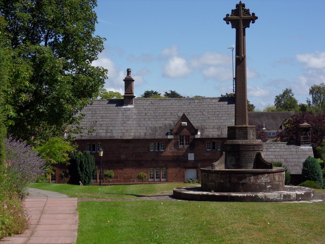
Image: © J Scott Taken: 5 Aug 2011
Many of the buildings developed around Caldy Manor in the 17th century, with further developments in the Victorian period particularly after the village was purchased by a Manchester businessman, Mr R. W. Barton in 1832, with the cross commemorating his contribution to the village.
Images are licensed for reuse under creativecommons.org/licenses/by-sa/2.0
Image Location


Leaflet Map data © OpenStreetMap
Latitude
53.358175
Longitude
-3.163822